Fig. 8
Download original image
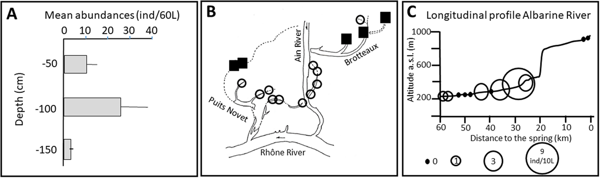
Distribution of Schellencandona rhodanensis sp. n. A. Vertical distribution in the sediment of the Valbonne gravel pit from March 1980 to September 1983 (mean abundance and standard error; n=6 sampling dates per depth). B. Lateral distribution in the wetlands of the Ain River (Puits Novet and Brotteaux) located close to the confluence with the Rhône River, at 16 sites, at −50 cm and −100 cm deep inside sediments, from March 1985 to September 1986 (n = 6–9 samples). Black square: species present in at least one sample. White circle: species absent. C. Altitudinal distribution in the bed sediment of the Albarine River, at 12 sites ranging from 939 to 220 m a.s.l. The size of the circle is proportional to the abundances (number of individuals per 10 L of pumped water).
Current usage metrics show cumulative count of Article Views (full-text article views including HTML views, PDF and ePub downloads, according to the available data) and Abstracts Views on Vision4Press platform.
Data correspond to usage on the plateform after 2015. The current usage metrics is available 48-96 hours after online publication and is updated daily on week days.
Initial download of the metrics may take a while.